 |
LabImagem - Laboratory of Digital Image Processing is a research unit created at the Applied Geodesy Division
of LNEC´s Concrete Dams Department, whose goal is to provide consultancy in the application of digital image
processing techniques (DIP) to Civil Engineering and on the subject of production, use and exploitation of
geographic information (Cartography and GIS).
The following areas of study are developed at LabImagem on the scope of projects INFRASAR and ImEngine
of LNEC’s 2013-2020 research and innovation plan:
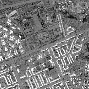
- Application of DIP to the administration of the territory, including
processing of satellite optical and SAR images, namely Landsat, SPOT,
IKONOS, WorldView, ERS, Envisat, etc., using pattern recognition methods
to extract information about land cover/use for decision support
systems (GEOSAT, RIVERSAR);
|
|
|
| 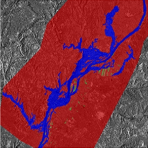
| Tile roof index (QuickBird red/green) | Flood zones delineation on SAR images
(OBIA – Object Oriented Image Analysis) |
|
- Application of RADAR interferometry with permanent scatterers
(PSINSAR) for detection of displacements on infrastructures (buildings,
dams, slopes);
|
|
|
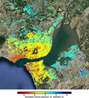 | 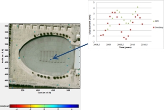 | PSINSAR LOS multitemporal displacements
at Lisbon metropolitan area
| Comparison of PSINSAR LOS multitemporal displacements
of a point on the exterior of the metallic roof of Meo Arena
Pavilion and levelling displacements on a point on the
interior roof wood structure
|
|
- Application of DPI techniques to the detection and survey of pathologies in engineering structures, through the processing of photographs obtained in inspection campaigns: construction of orthophotos and mosaics for general and detailed analysis of the structure;
|
|
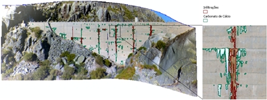 Orthophoto of a dam wall Classification of pathologies
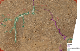
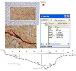
- Semi-automatic detection of pathological conditions (cracks, runoff, etc.);
Crack delineation on a dam wall and GIS integration
|
|
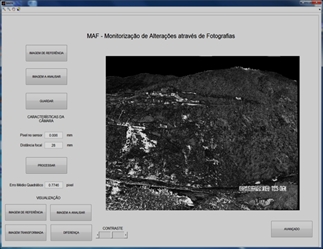
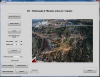
- Detection of movements in slopes located in construction sites, through photographs acquired at different times;
|
|
MAF Application to detect changes on slopes by image processing of multitemporal photographs
|
|
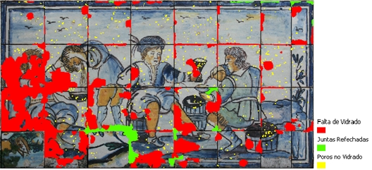
- Preparation of the Graphic Register of Damage of tiled facades on buildings and figurative panels, for planning of conservation and restoration actions;
|
|
|
- Monitoring of pathologies evolution;
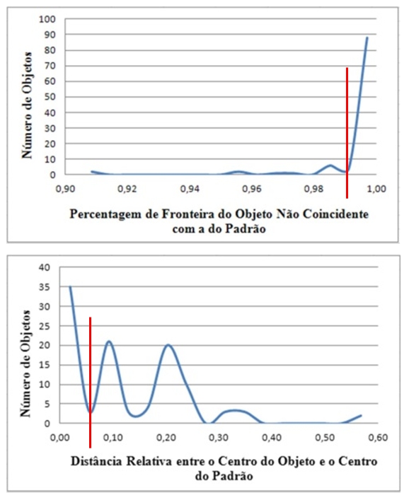 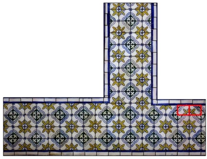 Automatic identification of rotated tiles Automatic identification of rotated tiles |
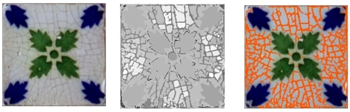 Original
| Homogeneity
| Craquelé
|
|
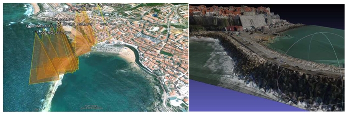
- Evaluation of the photographs acquired by unmanned aerial vehicles (UAV) for inspection of engineering structures.
|
|
|