Presentation
Presentation
Maria João Henriques
Head of Unit
The Applied Geodesy Unit develops research and innovation (R&I) activities, which provide support to many sectors of LNEC. Initially, the Applied Geodesy Unit focused on the geodetic observation of concrete dams with the main objectives of measuring displacements and contributing to understanding their behaviour. Given the relevance of this information, these methodologies were quickly adopted for the observation of other elements, both constructed and natural heritage.
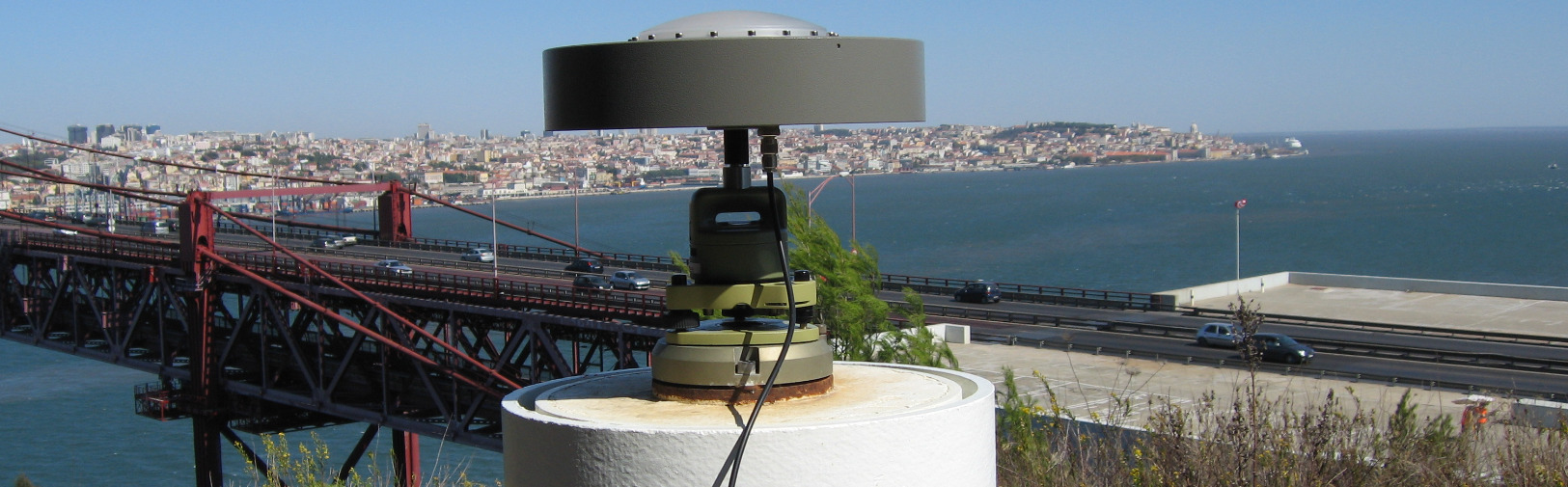
Technological developments, namely those associated with equipment on board artificial satellites, increased the portfolio of methodologies for displacement measurement, emphasizing GNSS (Global Navigation Satellite System) systems and SAR (Synthetic Aperture Radar) interferometry.
Data obtained by optical and laser sensors installed on terrestrial platforms, satellites or drones have boosted other R&I lines, namely digital image processing, with interest in the inspection of works (including the detection of pathologies), and the extraction of information on the geometry of objects, used for the reconstruction of 3D models and to detect shape and volumetric changes.
Activity
The activity of this Unit is divided into two main areas: geodetic monitoring and the extraction of information from digital images.
Geodetic monitoring is intended to measure displacements on structures. The used methodologies allow high-precision measurements and consider statistical approaches to treat observations and model uncertainties. The following methods are highlighted:
- those of applied geodesy, using robotic total stations and automatic levels
- the GNSS, which is particularly well suited to continuous monitoring; and
- SAR interferometry with persistent scatterers, using images acquired by synthetic aperture radar sensors.
Regarding digital images, sensors on board satellites or drones stand out. Digital image processing techniques allow obtaining relevant aspects of the analysed surfaces (pathologies), with application in structure inspection. When photogrammetric software is applied, the shapes of photographed objects can be reconstructed (through point clouds), which allows the detection of geometric changes.