 Concrete Dams Department
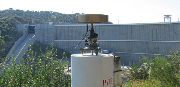
Applied Geodesy Unit
Publications
|
Papers
Info
Comparative analysis of MT-InSAR algorithms supported by GNSS data and corner reflectors: Assessing performance and accuracy

This paper presents a comparative analysis of Multi-Temporal Interferometric Synthetic Aperture Radar (MT-InSAR) algorithms in a corner reflector located in Lisbon, Portugal. The reflector was monitored using daily observations from the Global Navigation Satellite System (GNSS) technique with submillimeter precision. The study focuses on comparing the performance and accuracy of different MT-InSAR approaches i) the Persistent Scatterer Interferometry (PSI) method using the open-source software StaMPS, ii) the PSI method using the commercial software SARPROZ, iii) the Quasi-PS method implemented with the SARPROZ software, as well as iv) a hybrid method Persistent scatterer
Year: 2024
Number Pages:
7p..
Author(s): Diaz, A.; Roque, D.; Solla, M.; Lima, J. N.
: Procedia Computer Science
Editor: Elsevier
Volume:
239.
Keywords: Corner reflector; Accuracy; GNSS; QPS; PSI
Info
SARClust
Interferometric Synthetic Aperture Radar (InSAR) has proved its efficiency for displacementmonitoring in urban areas. However, the large volume of data generated by this technology turnsthe retrieval of information useful for structure monitoring into a big data problem. In this study, anew tool (SARClust) to analyze InSAR displacement time series is proposed. The tool performs theclustering of persistent scatterers (PSs) based on dissimilarities between their displacement time seriesevaluated through dynamic time warping. This strategy leads to the formation of clusters containingPSs with similar displacements, which can be analyzed together, reducing data dimensionality, andfacilitating the identification of displacement patterns potentially related to structural damage. Aproof of concept was performed for downtown Lisbon, Portugal, where ten distinct displacementpatterns were identified. A relationship between clusters presenting centimeter-level displacementsand buildings located on steep slopes was observed. The results were validated through visualinspections and comparison with another tool for time series analysis. Agreement was found inboth cases. The innovation in this study is the attention brought to SARClust
Year: 2023
Number Pages:
19p..
Author(s): Roque, D.; Falcão, A. P.; D. Perissin; Amado, C; Lemos, J. V.; Fonseca, A. M.
: Sustainability
Editor: MDPI
Volume:
15.
Keywords: Dynamic time warping; Hierarchical clustering; RADAR interpretation; InSAR; Structure monitoring
Info
Integrated InSAR and GNSS monitoring subsystem for an arch dam and reservoir banks
Interferometric synthetic aperture radar (InSAR) is a cost-effective method for displacement measurement at dams and reservoir banks, and is especially relevant for structures without embedded equipment or rarely monitored. However, the lack of redundant observations prevents the determination of a posteriori variances for InSAR measurements, which limits the uptake of the InSAR technology for structure monitoring. This paper presents a methodology for the integration of persistent scatterer interferometry (PSI) and Global NavigationSatellite System (GNSS) displacement measurements. Double differences between PSI and GNSS data are used as observations in a redundant network connecting the points of interest, with GNSS data used to constrain PSI measurements. This procedure allows the determination of adjusted displacements and a posteriori variances at all network points. Maximum uncertainty of 3 mm was achieved for displacementsalong the SAR sensor line-of-sight at both the dam and its surrounding slopes. The proposed method is of interest for monitoring purposes, because it allows displacement measurement at both the structure and its surroundings, together with the displacement uncertainty, which aids decision makers in the planning of maintenance operations for the whole area influenced by the dam.
Year: 2021
Number Pages:
12p.
Author(s): Roque, D.; Lima, J. N.; D. Perissin; Falcão, A. P.; Lemos, J. V.; Fonseca, A. M.
: Journal of Surveying Engineering
Editor: American Society of Civil Engineers
Volume:
147(3).
Keywords: Uncertainty assessment; Slope; Dam; GNSS; InSAR; Data integration; Monitoring system
Info
Analysis of periodicities in long-term displacement time series in concrete dams
The hydrostatic-season-time (HST) model is a widely used method in the safety assessment of dams and for the estimation of reversible and irreversible deformations due to different load scenarios. After implementing an optimal HST-model to observational data, the residual time series can still expose some underlying periodicities. In our contribution, the underlying periodicities and their contribution to residual minimisation are further analysed by the Lomb
Year: 2019
Author(s): Gamse, S.; Henriques, M. J.; Oberguggenberger, M.; Mata, J.
: Journal Structural Control and Health Monitoring
Editor: John Wiley & Sons, Ltd.
Keywords: multiple linear regression; Lomb
Info
Points clouds and orthomosaics from photographs
The three authors of this paper work at the Applied Geodetic Division of the National Laboratory for Civil Engineering (LNEC), in Lisbon, Portugal. LNEC is a state owned research and development institution founded in 1946. It works in the various domains of civil engineering (structures, hydraulic, geotechnics, environment, materials, among others), giving it a unique multidisciplinary perspective in this field. The main goals of the LNEC are to carry out innovative research and development and to contribute to the best practices in civil engineering.The Applied Geodetic Division nowadays develops works in two domains: the geodetic surveying of large dams and other engineering structures for monitoring purposes, and the processing of digital images with applications in several domains, which includes the study of the evolution of pathologies in engineering works. Originally the processing of digital images made use mostly of the chromatic information included in the images (from satellite images to close range photographs). But recently it has evolved to extract information of the geometry of the objects by the generation of point clouds. This use of close range photographs (from distances of decimetres to a few meters), which started in the summer of 2014, looks very promising and we, the authors, are identifying possible areas where the use of point clouds and orthomosaics that can be of interest to our colleagues of LNEC, civil engineers mostly. This paper presents the first examples where point clouds and orthomosaics, generated from close range photographs, can help civil engineers on their studies. The photogrammetic products were all generated using the free open-source software Micmac (Multi-Image Correspondances, Méthodes Automatiques de Corrélation) from IGN (Institut National de l
Year: 2016
Number Pages:
8p.
Author(s): Henriques, M. J.; Roque, D.; Braz, N.
: Coordinates Magazine
Editor: Coordinates Media Private Limited
Volume:
vol. 12 - Issue 9.
Keywords: Civil engineering; Structure; Monitoring; Point cloud; Orthomosaic
Info
Surveillance par drone des digues à talus
Les ports et autres infrastructures construits sur des côtes exposées à de fortes houles ont besoin d
Year: 2016
Number Pages:
5p.
Author(s): Henriques, M. J.
: XYZ
Editor: Association Francaise de Topographie
Volume:
148.
Keywords: Digue; Drone; Oscultation
Info
Using simplified bathymetry and SAR imagery in the validation of a hydraulic model for the Tagus River floodplain
This work presents several approaches in the validation of the hydrodynamic model Tuflow on the simulation of flood extents and water levels, based on satellite SAR imagery. A methodology that uses a simplified bathymetry in the river main course is employed, which proves to be reliable and accurate for high-flow events. This was made possible as the digital terrain model was acquired in a dry period, accounting for large dry areas in the river bed, avoiding in this way the need of expensive river bathymetry surveys. Also, two methods are applied to the SAR imagery to extract the flood boundaries: visual interpretation followed by manual delimitation and an object-based algorithm approach. The hydraulic model is tested on a reach of the Tagus River, Portugal, where the largest flood inundation areas occur, using a historical flood event to verify its robustness and reliability. The accuracy of model prediction is done through comparisons of water levels at a hydrometric station and the determination of commission and omission errors of flood extent, between the reference SAR image and the predicted inundation. It was concluded that the methodology followed in this work is well suited for the hydraulic model validation.
Year: 2016
Number Pages:
5p.
Author(s): Araújo, M. A. V. C.; R. Pestana; M. Matias; Roque, D.; Teixeira, A.; Heleno, S.
: Journal of Coastal Research
Editor: Coastal Education & Research Foundation
Volume:
75.
Keywords: Tuflow; Commission and omission errors; SAR imagery; Simplified bathymetry
Info
Port infrastructure control (Madeira Island, Portugal) through a hybrid monitoring system (GNSS and Accelerometers)
This article describes the implementation of a monitoring system on the breakwater at the Funchal Port (Madeira Island, Portugal) for the purpose of understanding its dynamic behavior and the temporal evolution of structural health. The monitoring system focuses on the breakwater superstructure and aims to identify the evolution of damage on the breakwater and analyze the impact of cruise ships docking and undocking. The system includes the measurement of displacements through geodetic techniques using global navigation satellite systems and the measurement of vibrations using accelerometers. Ten observation campaigns were performed over almost 3 years. As the measured displacements during this period were less than 7.5 mm it can be concluded that, despite some visible cracks, the breakwater superstructure did not suffer significant structural changes. It was shown from the measured acceleration records that some of the main modal parameters could be identified, namely the main natural frequencies of the superstructure. Through an analysis of the natural frequencies progression over time, it will be possible to identify deterioration effects on the foundation and/or the superstructure. The comparison of natural frequencies identified could be useful to evaluate the impact of these events on structural health.
Year: 2015
Number Pages:
617-629pp.
Author(s): Pereira, Mário; Teodoro, A.; Lima, J. N.; Oliveira, S.; Gomes, F.V.
: Journal Marine Georesources & Geotechnology
Editor: Taylor & Francis Group
Volume:
Volume 34, 2016 - Issue 7.
Keywords: Port; Docking/undocking; Breakwater; Accelerometers; GNSS
Info
Fusão de deslocamentos medidos com o GNSS e acelerações
A fusão de dados provenientes de diferentes tipos de instrumentos pode dar uma informação mais completa para a monitorização do comportamento de estruturas de engenharia civil, em particular nas pontes de grande vão. O objectivo da fusão de deslocamentos medidos com o GNSS e de acelerações, é tirar partido da precisão conseguida com o GNSS, em baixas frequências, e da grande sensibilidade dos acelerómetros, em altas frequências, e obter uma única série temporal de deslocamentos, longa e de grande resolução. Através dum filtro de Kalman será possível integrar deslocamentos medidos, com uma frequência de amostragem de, por exemplo, 1 Hz, e acelerações medidas, com uma frequência de amostragem de, por exemplo, 100 Hz, de modo a obter uma série temporal de deslocamentos de longa duração e com uma resolução de 100 Hz. Nesta comunicação apresentam-se os resultados preliminares dum ensaio realizado num modelo estrutural simples correspondente a um edifício de três pisos, instrumentado com antenas GNSS da Topcon e acelerómetros da Kinemetrics, modelo Episensor ES-U2, e da Nanometrics, modelo Titan SMA, tendo em vista a futura aplicação desta metodologia em pontes de grande vão.
Year: 2013
Number Pages:
10.
Author(s): Lima, J. N.; Oliveira, S.; Henriques, M. J.
: 3 ASCP, Actas do 3º Congresso da Associação Portuguesa para a Segurança e Conservação de Pontes
Editor: Associação Portuguesa para a Segurança e Conservação de Pontes
Keywords: Fusão; Acelerómetros; Monitorização; Pontes; Gnss
Info
SMOOTHING GNSS TIME SERIES WITH ASYMMETRIC MOVING AVERAGES
There is an increasing trend to apply GNSS continuous observation of short baselines to the monitoring of engineering works, such as bridges and dams, for their structural analysis and safety control. In the case of large dams, one important application of the GNSS continuous observation is the establishment of early warning systems that demand accurate, frequently updated information and where the analysis of the baseline time series, in order to separate signal from noise is mandatory. The paper presents a study on the performance of linear filters of the asymmetric moving average (AMA) type to smooth baseline time series. The transfer function of the AMA is adopted as a smoothing criterion to define an adequate order for the AMA, in face of the spectral density function of the baseline time series. One series of measurements of a short test baseline (325 m), materialized in the campus of the National Laboratory for Civil Engineering, is used as an example of the proposed strategy.
Year: 2012
Number Pages:
6.
Author(s): Lima, J. N.; Casaca, J. M.
: Journal of Civil Engineering and Architecture
Editor: David Publishing Company
Volume:
Volume 6, Number 6.
Keywords: Spectral density; Signal; Noise; Moving average; Gnss
|
|
Comunicação
Info
Precision assessment of PSI displacements at a corner reflector infrastructure for Sentinel-1
An infrastructure of three corner reflectors for Sentinel-1 was deployed at the National Laboratory for Civil Engineering campus, in Lisbon, Portugal, with the collaboration of the IDL, FCUL. The infrastructure is formed by two triangular trihedral reflectors (1 x 1 m) and by a third one following a model proposed by the team. The third reflector is formed by two rectangular trihedrals with the vertical axis in common, each of the individual reflectors is oriented towards the ascending and the descending passes of Sentinel-1. Additionally, a Global Navigation Satellite System (GNSS) antenna is permanently installed on the reflector
Year: 2019
Author(s): Roque, D.; Morais, J.; Falcão, A. P.; Lima, J. N.; D. Perissin; Morais, P.; Catalão, J.; Lemos, J. V.; Fonseca, A. M.
Editor: European Space Agency
Keywords: Corner reflector; Precision assessment; Sentinel-1
Info
Project "ELEVAR"
The
Year: 2019
Author(s): Dornellas, D.; Gonçalves, J.; Ribeiro, R.; Bernardino, A.; Santos-Victor, J.; Rosa, F.; Rodrigues, F.; Henriques, M. J.; Batista, A. L.; Gnanasekaran, N.
Editor: International Federation of Surveyors
Keywords: estrutura; monitorização; drone; UAV
Info
Projeto ELEVAR
O projeto "ELEVAR
Year: 2019
Author(s): Henriques, M. J.; Pinto, T.; Andrade, J.; Dornellas, D.; Gonçalves, J.; Ribeiro, R.; Bernardino, A.; Santos-Victor, J.; Batista, A. L.
Editor: Associação de Laboratórios Acreditados de Portugal (RELACRE)
Keywords: drone; UAV; monitorização
Info
Validation of PSI displacements at a bidirectional corner reflector
The team developed a bidirectional corner reflector (CR) with the goal of achieving displacements from Sentinel-1 ascending and descending passes for the same point. From those observations, vertical and horizontal displacements are being determined and their uncertainty is being assessed through comparison to levelling and GNSS measurements.The bidirectional CR is composed by two rectangular trihedrals with the vertical axis in common. A GNSS antenna is permanently installed on that axis and the base where the reflector is installed enables it to move along pre-defined directions. The reflector vertical displacements are also being monitored through levelling every two weeks. This CR is part of an infrastructure installed in LNEC, which also includes two individual triangular trihedral CRs. One of those is also installed on a movable base, in order to allow the comparison between CRs of different shapes.Two evaluations of the measurements
Year: 2019
Number Pages:
1p.
Author(s): Roque, D.; Morais, J.; Falcão, A. P.; Lima, J. N.; D. Perissin; Morais, P.; Catalão, J.; Lemos, J. V.; Fonseca, A. M.
Editor: Le CNAM
Keywords: precision; Corner reflector; InSAR
Info
Accessing the Accuracy of Surveying/Photogrammetric Methods to Identify Damages on Physical Models of Rubble Mound Breakwaters
During the design process of rubble mound breakwaters scale model, tests are required to study the hydraulic and structural behaviour of the proposed structure under predefined sea wave conditions. The main goal of such tests is to study the structure overtopping and infer on damage progression by quantifying displacements of the armour layer units. To detect and measure these displacements different methodologies were tested: photogrammetry and 3D scan. All the methods were used to produce point clouds. Some points on the model of the breakwater and its surroundings were coordinated by surveying methods and used to access the accuracy. This paper describes the methodologies used and the results achieved.
Year: 2018
Author(s): Henriques, M. J.; Lemos, R.; Capitão, R.; Jónatas, R.; Fortes, C. J. E. M.; Silva, H.
Editor: International Federation of Surveyors
Keywords: models; monitoring; 3D scan; photogrammetry; engineering survey
Info
Analysis of InSAR displacements for the slopes around Odelouca reservoir
Odelouca is the second largest earth dam in Portugal and holds an important water reservoir. A displacement map for the slopes around the reservoir during the initial phase of the first filling was built using a multitemporal interferometric synthetic aperture radar (MTI) technique. A method based on cluster and time series analysis is proposed in order to find patterns on the obtained scatterers. The points are aggregated through a measure of the similarity between their displacement time series and form clusters, whose properties can then be evaluated. The analysis can be complemented by additional information for a better understanding of the influence on the ground of the storage of such a large amount of water. Three different patterns were identified on the data: stable scatterers, scatterers moving away from the sensor and scatterers moving towards it. A set of outliers was also detected. One of the clusters may contain points susceptible to landslide occurrence.
Year: 2018
Number Pages:
338-345pp.
Author(s): Roque, D.; D. Perissin; Falcão, A. P.; Amado, C; Lemos, J. V.; Fonseca, A. M.
: Procedia Computer Science
Editor: ELSEVIER
Volume:
138.
Keywords: Odelouca dam; Time series analysis; Cluster analysis; Slope instability; Radar interpretation
Info
Deciphering magma plumbing system at Fogo volcano using geodetic (InSAR, GNSS and gravimetric) data
Fogo volcano is one of the most active volcanoes in the Atlantic, with 27 eruptions since the Portuguese settlement in the early 15th century. Located nearby the center of a 9 km-wide truncated caldera, Chã das Caldeiras, Fogo is a stratovolcano capped by a 500 m-wide summit crater that rises ~1 km above the caldera floor. It has been interpreted as a recent structure formed at the top of an older volcanic edifice that would have collapsed about ~117 or at ~73 ka. Evidences of this collapse can be seen on land as illustrated by the horseshoe shape of Chã das Caldeiras and the tsunami deposit recognized on the neighboring Santiago island and offshore, with landslide debris deposit; even though its origin is still debated. Eruptive activity at Fogo includes both explosive and effusive phases with alkaline products ranging from basic to intermediate compositions. Eruptive fissures that fed lava flows are mostly distributed along three rift zones that are north, southwest and southeast oriented. The recurrence time for eruption is ranging from 1 to 94 years, with a 20 year interval for the three last eruptions. The last eruption started on November 23, 2014, ending February 7, 2015. The 2014-2015 fissure was 700 m long and included up to seven vents where lava was emitted and where strombolian and vulcanian explosions took also place. This eruption as well as the 1951 and 1995 ones have produced extensive lava flows that threatened the local populations resulting in 2014-2015, in the total destruction of two villages, Portela and Bangaeira. Interferometric analysis of the 1995 and 2014-2015 eruptions at Fogo volcano using C-band SAR data have allowed to characterize the feeder dykes of the two eruptions without any evidence of shallow magma reservoir. Recent petro-geochemical analyses suggested the existence of a transient magma chamber, located <1.5 km below sea level, where magma would have been stored ~50 days prior to the onset of the eruption. To unravel the existence of this transient reservoir and the related volcanic plumbing system at Fogo and also investigate the processes leading to the eastward flank movement, we have considered X-band SAR satellite and field-based GNSS data. We used COSMO-SkyMed SAR data acquired from July 2013 to the end of the eruption in both ascending and descending configurations to investigate surface deformation during the pre and co-eruptive period. The tropical atmospheric conditions, the highly non coherent material composing Fogo volcano and the extensive lava field make challenging the interferometric analysis in this volcanic environment. Therefore, InSAR analysis was completed by GNSS measurements. The surface deformation was analyzed for the 20 years using a compilation of GNSS campaign data performed in 1998, 1999, 2000, 2014-2015 (eruptive period) and 2017, suggesting a horizontal displacement rate up to 2 mm/yr with respect to Nubia plate. The acquired gravimetric data (~90 points) since 2014 combined with the new computed Digital Terrain Model is used here to provide complementary observation on the magma plumbing system of the volcano. This is a contribution to Project FIRE (PTDC/GEOGEO/1123/2014) funded by FCT (Portugal). The GNSS solutions were computed using resources provided by C4G
Year: 2018
Number Pages:
2p.
Author(s): Fernandes, R.; Dumont, S.; Roque, D.; Martins, B.; Falcão, A. P.; Bos, M.; Heleno, S.
Editor: American Geophysical Union
Keywords: Fogo volcano
Info
Monitoring dam displacements with GNSS: strategy, accuracy and benefits
Several permanent stations for observation of GNSS (Global Navigation Satellite System) precision baselines were installed, in 2016, in four Portuguese large concrete dams, in order to monitor horizontal displacements. The results presented in the paper show that there is a great potential for the use of GNSS technology in dam monitoring systems.The paper describes the filtering strategy used to process the observations in order to achieve the millimeter accuracy level as well as a Bayesian procedure developed to automatically identify and eliminate outliers and gross errors.Finally, the benefits of such techniques, including the potential of the GNSS in the domain of dam displacement real-time monitoring, are described.
Year: 2018
Number Pages:
10p.
Author(s): Lima, J. N.; Casaca, J. M.
Editor: Dam World
Keywords: Credible ellipses; Dam monitoring; GNSS; Filtering
Info
Monitorização de deslocamentos em grandes barragens utilizando GNSS. Aplicação à barragem do Cabril
No controlo da segurança de barragens é fundamental monitorizar os deslocamentos das obras ao longodo tempo e efetuar, continuamente, a comparação entre os deslocamentos observados e os previstos combase em modelos numéricos, geralmente modelos de elementos finitos tridimensionais (MEF3D). Namonitorização de deslocamentos utilizam-se fios de prumo, métodos geodésicos ou, mais recentemente,sistemas GNSS (Global Navigation Satellite System) que permitem a monitorização de deslocamentosem contínuo. No caso da barragem do Cabril, apresentada neste trabalho, em operação desde 1954, nãoforam instalados fios de prumo na secção central pelo que a monitorização de deslocamentos nestasecção tem sido efetuada por métodos geodésicos clássicos que não permitem a monitorização emcontínuo (apenas duas campanhas de observação por ano). Deste modo, entendeu-se que, no caso destaobra, o uso do GNSS seria particularmente útil, pois permite uma monitorização em contínuo dodeslocamento no topo da secção central. Como a barragem de Cabril apresenta problemas de fendilhação,desde a fase de primeiro enchimento, é importante medir continuamente o deslocamento em váriospontos notáveis, como é o caso do topo da secção central. O presente trabalho foca-se na validação dosdeslocamentos medidos por GNSS na barragem de Cabril. Para tal é utilizado um modelo numérico deelementos finitos 3D (MEF3D), desenvolvido em MATLAB, no qual a fissuração é simulada através deelementos de junta. O MEF3D foi calibrado com base em deslocamentos observados por fios de prumo(em duas secções não centrais) e por métodos geodésicos clássicos, considerando as variações da pressãohidrostática e as variações anuais de temperatura registadas na obra. As histórias de deslocamentosobservados por fios de prumo e métodos geodésicos foram analisadas usando um Modelo de Separaçãode Efeitos (MSE), para facilitar o processo de comparação entre os deslocamentos observados e osresultados numéricos. Desta forma, o modelo EF3D foi calibrado com base nos deslocamentosobservados pelos métodos clássicos e, em seguida, foi usado para validar os deslocamentos medidos porGNSS.
Year: 2018
Number Pages:
10p.
Author(s): Oliveira, S.; Lima, J. N.
Editor: Grupo Português de Betão Estrutural (GPBE)
Keywords: Monitorização; Modelos de separação de efeitos; Modelos de elementos finitos 3D; GNSS; Barragens abóbada
Info
O GNSS na monitorização de deslocamentos de Grandes Barragens de Betão Portuguesas
A observação permanente de bases GNSS (Global Navigation Satellite System) de precisão foi introduzida recentemente em Portugal, na monitorização de deslocamentos horizontais de grandes barragens de betão. Os resultados dos sistemas instalados em quatro grandes barragens, apresentados nesta comunicação, mostram a grande eficácia da aplicação do GNSS à monitorização de deslocamentos em grandes barragens de betão. A comunicação descreve duas estratégias para reduzir o ruído das observações e melhorar a qualidade dos resultados. A primeira estratégia, baseada num procedimento Bayesiano, permite identificar e eliminar erros grosseiros que afetam cerca de 5% das medições horárias. A segunda estratégia, baseada em filtros numéricos, permite suavizar as observações e atingir incertezas de medição milimétricas. Finalmente, são apresentados os benefícios da utilização destes métodos e o seu impacto no potencial do GNSS na monitorização de deslocamentos de grandes barragens de betão em tempo quase-real.
Year: 2018
Number Pages:
8p.
Author(s): Lima, J. N.; Casaca, J. M.
Editor: Ordem dos Engenheiros
Keywords: Monitorização de barragens; Elipses de credibilidade; GNSS; Filtros
|
|
Books
Info
História Breve do Calendário
O calendário Gregoriano não é mais do que uma reforma do calendárioJuliano, devido a Júlio César, que adaptou os formalismos romanos a uma antigaestrutura solar de origem egípcia. Este ensaio descreve a história do calendárioGregoriano e dos calendários da bacia do Mediterrâneo e do Oriente Próximo,com ele mais ou menos aparentados.
Year: 2009
Number Pages:
61pp.
Author(s): Casaca, J. M.
Editor: LNEC
Keywords: Calendários
|
|
Tese de Doutoramento
Info
Displacement measurement through InSAR geodesy for structural health monitoring
Interferometric synthetic aperture RADAR is an applied geodesy technique, which enables displacement measurement through satellite images. A literature review of the technique principles and of previous studies regarding its application to structural health monitoring allowed the identification of a few bottlenecks to the operational usage of this cost-effective technology for monitoring purposes.Three research lines were defined. First, a data mining strategy was developed to extract structural behaviour information from displacement time series from thousands of points on the region of interest, with tens of observation epochs each. Second, displacements from this technique were integrated into a previously existing monitoring system and were used to expand it to a larger number of points on the structure and to its surroundings. Third, an experimental infrastructure was deployed in order to perform several tests for displacement validation and uncertainty assessment. The infrastructure included a new model of artificial reflector to the satellite signals, purposefully developed in the scope of this study.The developed methods enabled the successful monitoring of different types of civil and geotechnical structures. Slope behaviour around water reservoirs was assessed during both the reservoir first impoundment and regular operation. Differential displacements were detected on building-blocks at a cultural heritage urban area and concrete arch dam responses to temperature loads were identified. The experimental work showed the achieved displacements agreed with those of other geodetic techniques and uncertainties around 2 mm were obtained for the measurements.In conclusion, interferometric synthetic aperture RADAR is a promising technique, able to provide useful information for structure monitoring, such as aiding in the planning of in situ monitoring activities and in identifying space-time patterns in structural behaviour. Thanks to its spatial coverage, observation period of a few days and achieved displacement uncertainty, it is advantageous to complement existing monitoring systems with data from this technique.
Year: 2020
Author(s): Roque, D.
Keywords: Uncertainty analysis; Data mining; Interferometric synthetic aperture RADAR; Geodesy; Structure monitoring systems
|
|
Relatório Científico
Info
A incerteza de medição dos distanciómetros eletromagnéticos usados na observação geodésica de barragens de betão
Este relatório apresenta uma metodologia para controlo dos erros instrumentais e avaliação da incerteza de medição dos distanciómetros eletromagnéticos (DEM) usados na observação geodésica de barragens de betão. A metodologia, que é baseada numa base de teste existente no campus do LNEC, é ilustrada com a análise de seis medições da base, entre 2010 e 2014, com os dois DEM utilizados pelo Núcleo de Geodesia Aplicada.
Year: 2015
Author(s): Casaca, J. M.; Henriques, M. J.; Conde, V.; Candeias, H.
Keywords: Teste de hipóteses; Desvio padrão; Dem; Constante aditiva
Info
GNSS and accelerometers data fusion in large structures monitoring
The monitoring systems have two main objectives: (i) to evaluate the safety conditions and durability of the infrastructures and to develop a better understanding about their day-to-day behaviour; (ii) to detect the occurrence of special events that might jeopardize the safety of the structure. To reach the first objective it is mandatory to create a database as most extensive as possible to support an analysis of the structural behaviour. Regarding the second objective near real-time automatic systems must be created in order to analyse the recorded data and establish limits of alert with alarm warnings when those limits are exceeded. This R&D project aims to develop a measurement system, based on GNSS (Global Navigation Satellite Systems), suitable to monitor large scale civil engineering structures and infrastructures, particularly bridges and dams. This monitoring system final objective is to measure the displacements of some selected points of the structures. These points should be the most important ones to characterize the general behaviour of the monitored structure. The advantages of using a GNSS system are undeniable: this equipment is robust, operates under all weather conditions, does not require intervisibility between the monitored points and the reference points, uses an external tridimensional reference systems, and provides an extremely accurate time-reference frame. The GNSS positioning is affected by a numerous set of errors due to natural and artificial phenomena. These errors should be reduced as much as possible, in order to obtain good estimated distances between the observed satellites and the antenna of the receivers. There are well known observation and observation combination techniques (phase differences measurements, relative positioning and Precise Point Positioning - PPP) that allow to strongly reduce, or sometimes even eliminate, most of the errors. Using carefully selected observation and processing techniques it is possible to obtain high-precision GNSS positioning. The RTK (Real Time Kinematics) is the more recent high-precision positioning GNSS technique. It allows us to obtain high quality coordinates in almost real-time. When used in conjunction with top grade receivers (able to do observations at high frequencies) the RTK seems to be able to monitor high frequencies displacements of structures. Unfortunately the positioning precision is only at the centimetre level. To reduce this uncertainty it will be used short baselines and processing techniques based on the use of various filters and methodologies for multi-sensor observations fusion. It is precisely in the development of these techniques that the actual research project is focused. After the monitoring system specification, several techniques will be developed and tested in order to be included in a reliable measurement system that will meet the specified requirements. To define the monitoring system demands the following items have been addressed: - Requirements of the monitoring system in view of the behaviour of the selected structures; - Acquisition of know-how on data acquisition systems and in-site monitoring equipment; - Identification, characterization and analysis of software available for data processing.
Year: 2015
Author(s): Lima, J. N.; Oliveira, S.; Henriques, M.
Keywords: Data fusion; Large structure monitoring; Accelerometers; GNSS
Info
Aplicação das técnicas de inspeção visual assistida na monitorização de ensaios de flexão até à rotura de vigas de madeira
A inspeção visual assistida pode ser utilizada para a monitorização de ensaios de flexão atéà rotura de vigas de madeira, tendo sido usado um sistema de observação com fotografia evídeo. Foi desenvolvido um programa para identificação automática das imagens da viga,que registaram alterações significativas, tendo a fratura sido delineada através de técnicasde análise de imagem orientada por objetos.
Year: 2013
Number Pages:
31pp.
Author(s): Roque, D.; Fonseca, A. M.
Editor: LNEC
Keywords: Vigas de madeira; Análise de imagem orientada por objetos; Processamento digital de imagem; Inspeção visual assistida
Info
Desenvolvimento de aplicações informáticas para o processamento digital de imagens em linguagem MATLAB
A extração de informação a partir de imagens digitais tem-se tornado numa prática comum em váriasáreas do conhecimento. Foi desenvolvido um programa em MATLAB para permitir a um utilizador nãoespecializado a realização de tarefas simples de processamento digital sobre imagens adquiridas porvários géneros de sensores.
Year: 2013
Number Pages:
19pp.
Author(s): Roque, D.; Fonseca, A. M.
Editor: LNEC
Keywords: Análise multitemporal; Análise multiespectral; Operações de realce; Processamento digital de imagem
Info
Levantamento térmico de paramentos de barragens de betão para apoio ao acompanhamento da evolução de patologias
O relatório apresenta os princípios gerais da termografia e a sua aplicação prática no levantamentotérmico de paramentos de barragens de betão para apoio ao acompanhamento da evolução depatologias. Apresentam-se aplicações relativas ao levantamento térmico dos paramentos de jusantedas barragens do Alto Ceira II, Alto Ceira e Cabril. O levantamento realizado na primeira barragem,que se encontrava na fase final de construção e ainda vazia, permitiu a avaliação da qualidade dosresultados obtidos (temperaturas superficiais do paramento) por comparação com valores medidospor termómetros embebidos no betão. Nas outras duas barragens, ambas apresentando problemasde infiltrações, permitiu avaliar a aplicabilidade das imagens térmicas na deteção de ressurgimentosde água na superfície do betão, geralmente indicativas da existência de repasses de água.
Year: 2013
Number Pages:
53pp.
Author(s): Henriques, M. J.
Editor: LNEC
Keywords: Infiltração; Paramento; Temperatura; Levantamento térmico; Barragem de betão
Info
Utilização de veículos aéreos não tripulados para a monitorização de infraestruturas - Aplicação ao quebra-mar da Ericeira
O presente relatório apresenta uma experiência de aquisição de fotografias aéreasutilizando um veículo aéreo não tripulado (VANT) para recolha de informação geográfica doquebra-mar da Ericeira, com o objetivo de testar a capacidade destes dados para produçãode ortofotomapas e modelos numéricos de superfície para monitorização de infraestruturasao longo do tempo. A experiência foi realizada numa colaboração entre o LNEC e aempresa SINFIC, SA
Year: 2013
Number Pages:
39pp.
Author(s): Fonseca, A. M.; Roque, D.; Lima, J. N.; Henriques, M. J.; Marnoto, J.
Editor: LNEC
Keywords: Avaliação da qualidade; Modelos numéricos de superfície; Ortofotos; Vant; Monitorização de infraestruturas
Info
Memorando sobre a inspecção visual assistida de paramentos de barragens de betão
Neste relatório faz-se a síntese dos métodos disponíveis para realizar a Inspecção Visual Assistida(IVISA) de paramentos de barragens de betão, no que diz respeito às várias fases envolvidas: aquisiçãode imagens, processamento, monitorização temporal e arquivo. Apresentam-se os recursos existentesno LNEC e a adquirir, assim como os custos associados.
Year: 2011
Number Pages:
20pp.
Author(s): Fonseca, A. M.; Roque, D.; Baptista, B.; Afonso, N.
Editor: LNEC
Info
O ruído da medição relativa GNSS com elevada frequência de amostragem
N/A
Year: 2009
Number Pages:
35pp.
Author(s): Lima, J. N.; Casaca, J. M.; Henriques, M. J.
Info
O teste de equipamento de nivelamento geométrico de precisão segundo a Norma ISO 17123-2:2001 (E)
Este relatório apresenta um procedimento para a avaliação da incerteza de medição de equipamento de nivelamento geométrico de precisão e ainda regras para o teste estatístico de hipóteses sobre essa incerteza de medição, preconizadas na segunda parte da norma ISO 17123, exemplificados com um ensaio comparativo de um nível automático numérico Wild NA 3003 e de um nível automático Wild NA2, com um micrómetro óptico acoplado.
Year: 2008
Number Pages:
24pp.
Author(s): Casaca, J. M.; Henriques, M. J.; Coelho, J. I.
Keywords: Iso 17123-2:2001 (e); Nivelamento geométrico de precisão; Teste de equipamento
|
|
ICT
Info
A distribuição do desvio padrão empírico
O trabalho aborda simultaneamente a distribuição do desvio padrão da amostra aleatória normal e a distribuição do desvio padrão do modelo de Gauss-Markov, designados genericamente por desvio padrão empírico. Após mostrar que o desvio padrão empírico é um estimador excêntrico que subestima o desvio padrão da amostra ou do modelo, conforme o caso, são apresentadas correções de excentricidade. É também tratada a estimação do desvio padrão da amostra e do modelo em cenário Bayesiano, com diferentes distribuições anteriores. O trabalho é rematado por casos de estudo baseados na simulação de amostras normais e por um exemplo concreto relacionado com o controlo da precisão de um distanciómetro eletromagnético.
Year: 2015
Author(s): Casaca, J. M.
Keywords: Desvio padrão
Info
A resolução de problemas mal colocados na observação geodésica de barragens
O presente trabalho apresenta uma metodologia genérica para a regularizaçãode problemas inversos lineares mal colocados e a sua aplicação às redes altimétricas eplanimétricas usadas na monitorização de deslocamentos de pontos notáveis de grandesbarragens por métodos da Geodesia Aplicada. A metodologia é ilustrada por intermédiode três casos de estudo.
Year: 2013
Number Pages:
39pp.
Author(s): Casaca, J. M.
Editor: LNEC
Keywords: Observação geodésica; Observação de barragem
Info
The Beta-Binomial Model
This paper deals with the beta-binomial model, which is an important stochasticmodel within the scope of the Bayesian statistical inference. After a short review of the binomialand beta distributions, the paper presents the closed formulae for the posterior probabilitydensity function of the binomial trial parameter and for the prior predictive and forthe posterior predictive probabilities of the successes in binomial experiments. A descriptionof the Bayesian methodology to test different hyper-parameters for the conjugate priorprobability density functions of the beta family is also presented. Finally, the beta-binomialmodel is illustrated with a study case related to the quality control of the geodetic observationof large dams.
Year: 2013
Number Pages:
24pp.
Author(s): Casaca, J. M.
Editor: LNEC
Keywords: Binomial distribution; Beta distribution; Bernoulli trial parameter; Bayes factor
Info
Análise de regressão multivariada - Uma perspetiva Bayesiana
O presente trabalho, além de uma revisão sintética da abordagem frequencista,trata da abordagem Bayesiana da análise de regressão linear multivariada. É apresentadauma compilação de procedimentos e fórmulas para a estimação dos coeficientes da regressão,sob três cenários de informação anterior. Finalmente, o trabalho ocupa-se dosproblemas da predição de respostas e da comparação de modelos de regressão.
Year: 2012
Number Pages:
47pp.
Author(s): Casaca, J. M.
Editor: LNEC
Keywords: Estatística bayesiana; Análise de regressão; Análise multivariada
Info
The Gamma, Multi-gamma, Digamma and Trigamma Functions
The work presents the theoretical definitions of the gamma, multi-gamma, digammaand trigamma functions as well as operational approximations to compute their values.A more precise alternative, due to Robert Windschitl, to the traditional approximationof the gamma function by the Stirling
Year: 2012
Number Pages:
20pp.
Author(s): Casaca, J. M.
Editor: LNEC
Keywords: Trigamma-function; Digamma-function; Multi-gamma function; Gamma functions; Windschitl approximation; Stirling
Info
Introdução à análise Bayesiana
O trabalho descreve os princípios da análise Bayesiana, usando como caso deestudo a amostra aleatória normal identicamente distribuída. Após um curto preâmbulohistórico, são resumidos, na Secção 2, os conceitos mais importantes da análise frequencista.Nas secções seguintes, são abordados os temas Bayesianos mais importantes, taiscomo a estimação, pontual e regional (Secção 5), e o teste de hipóteses sobre osparâmetros da distribuição da amostra (Secção 6). As distribuições anteriores de Laplace,Jeffreys e conjugada normal-gama invertida são apresentadas na Secção 4. O problemada eliciação paramétrica das distribuições anteriores conjugadas é tratado na Secção 7.Palavras Chave: distribuições anteriores e posteriores, divergência de Kullback-Leibler,eliciação paramétrica, factor de Bayes, fórmula de Bayes, verosimilhança.
Year: 2011
Number Pages:
78pp.
Author(s): Casaca, J. M.
Editor: LNEC
Keywords: Análise bayesiana
Info
Estratégia para a Calibragem dos Distanciómetros Electromagnéticos Utilizados na Observação Geodésica de Barragens
Este trabalho define uma estratégia, apoiada o mais possível nas disponibilidades do LNEC, para a calibragem dos distanciómetros electromagnéticos (DEM) usados pelo Núcleo de Geodesia Aplicada na observação geodésica de barragens.
Year: 2002
Number Pages:
38.
Author(s): Henriques, M. J.
Editor: LNEC
Keywords: Base de teste; Dem; Distanciómetros; Calibragem
|
|
Outro
Info
Integration of image processing tools for monitoring breakwaters models
N/A
Year: 2016
Author(s): Soares, F.; Henriques, M. J.; Braz, N.
Editor: ESA
Keywords: Quebra-mar; Monitorizaçao
|