 Hydraulics and Environment Department
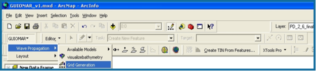
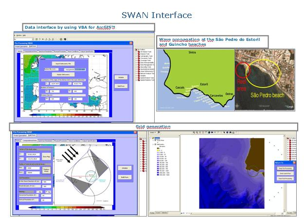
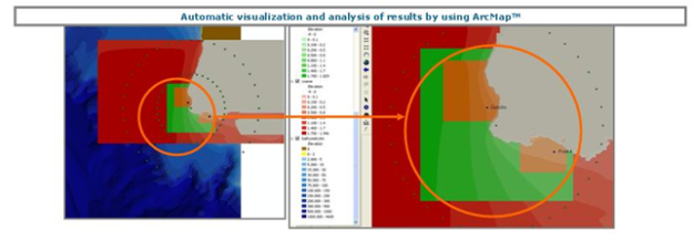
Projects - GUIOMAR – Geo(graphical) User Interface for cOastal and MARine modeling
The main objectives of the Project are:
- Development of a prototype of an integrated system, appropriated to help in the decision-making process in coastal engineering studies, using GIS huge capabilities. The system must be modular, to enable its easy expansion, must be built as a single application and be able to coordinate the tasks related with the running of the models (including automatic procedures for visualization and analysis of data and results that are relevant for the decision-making process);
- Assessment of the errors associated with the use of the system and their influence in the decision-making process: errors associated with e.g. bathymetric interpolations, data transfer between grids of different resolutions, model coupling, or simplification of physical boundaries;
- Development of an extension for emergency situations for the Sines harbour, including the simulation of several scenarios in order to build risk maps;
- Establishment of guidelines for coastal engineering studies with numerical models.
« return